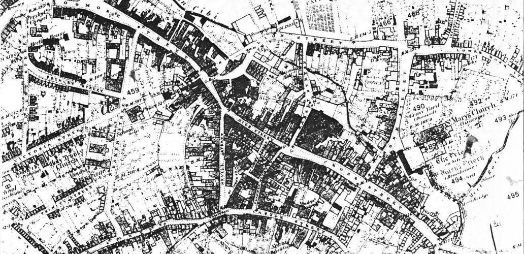

This survey has been attempted to make a record of the main streets of Abergavenny. The town grew very gradually in size until the mid years of the 19th century; since then it has doubled in size. The Local History Society has concentrated on the main streets which would have been there since mediaeval times […]
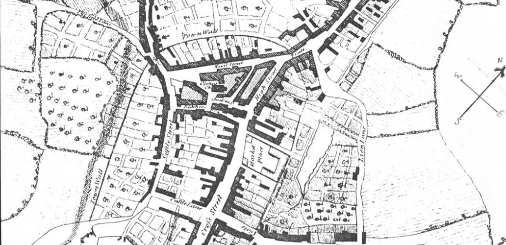
View Records Today the street extends from the Town Hall to the Swan Hotel. At one time the premises below the Coach and Horses Inn (once the Sun Inn, and much earlier, the site of the South Gate of the medieval town wall) were part of Mill Street. The 1881 map shows that the […]
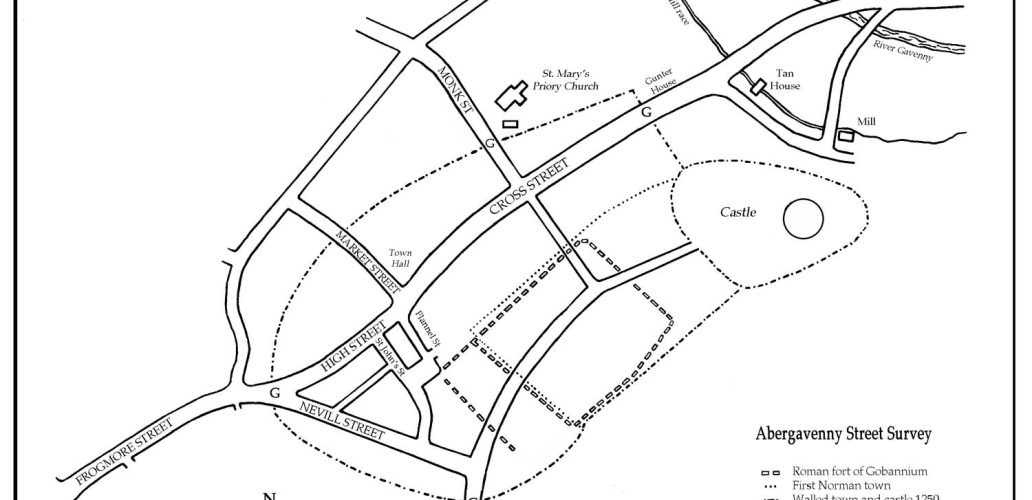
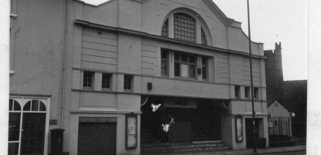
View Records The street once linked Cross Street (the main thoroughfare of the walled town) to Castle Street. From archaeological evidence this was the area of prehistoric settlement and later in the 11th and 12th centuries, the main street of the Norman town. In the early 1960s the western end, together with most of Castle […]
View Records Numbers run from the medieval North Gate, marked with an Abergavenny Local History blue plaque on 2, Frogmore Street (currently NatWest Bank) to the First World War Monument. Properties beyond the monument, except Frogmore Street chapel, are not covered in this survey. Numbers on the west side of the street return from the […]
View Records This street runs from the medieval north gate to the crossing of Flannel Street and Market Street. Below this it becomes Cross Street. The east side still shows a burgage pattern, but the wedge behind the west side suggests an early market site. The name may come from the Norman custom of raising […]
One of the main west-east axes dividing the planned late Norman 13th century town into its typical regular blocks. Market Street runs from the wide north end of Cross Street to the line of the Town Wall. (This is the line of the rear wall of the Butter Market Hall.) In a deed of 1616 […]
The numbering of the street is difficult. Even numbers on the north side begin at No 4 (No 2 having been demolished and No 6 represents the space below it). The lean-to shop against No 10 is included with No 8 (Laburnum House). The even numbers continue to No 32 (Gabbs) and in the 19thC […]